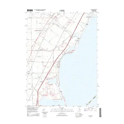
2014 Map of Erie
USGS Topo · Published 2014About this map
The western shoreline of Lake Erie defines this part of Monroe County, Michigan, where the land meets North Maumee Bay and La Plaisance Bay. This coastal landscape is shaped by a series of peninsulas and marshes, most notably the Woodtick Peninsula and various inland drainage systems like Yetter Drain and Cousino Drain. Along the lakefront, established communities such as Luna Pier and Bolles Harbor sit alongside numerous beach developments, including Avalon Beach and North Shores.
Find a feature on this map
86 named features on this map. Tap any name to fly to it.
Don’t see what you’re looking for? This feature index may not catch every label — zoom into the map to look around manually.
Map Details
Editions of this 2014 Erie Map
This is the sole edition of this map. No revisions or reprints were ever made.
Other maps of this area

1900 · Maumee Bay
USGS Topo · 1:62,500

1900 · Toledo
USGS Topo · 1:62,500

1912 · Monroe
USGS Topo · 1:62,500

1912 · Dundee
USGS Topo · 1:62,500

1914 · Monroe
USGS Topo · 1:62,500

1926 · Dundee
USGS Topo · 1:62,500

1927 · Monroe
USGS Topo · 1:31,680

1934 · Reno Beach
USGS Topo · 1:24,000

1934 · Point Place
USGS Topo · 1:24,000

1936 · Samaria
USGS Topo · 1:31,680
Featured Places
- Monroe Charter Township, MI
- LaSalle, LaSalle Township
- LaSalle Township, MI
- Erie, Erie Township
- Erie Township, MI