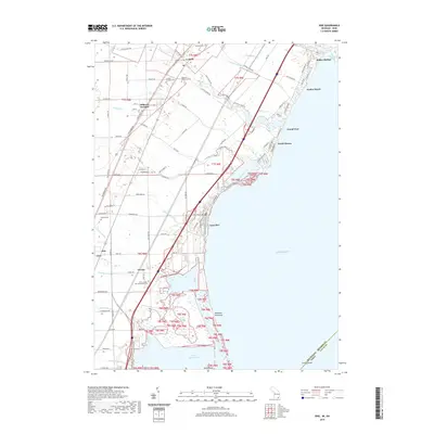
2019 Map of Erie
USGS Topo · Published 2019About this map
Lake Erie defines the eastern edge of this shoreline landscape, where the waters of North Maumee Bay meet the Michigan coast. The area exhibits a distinct transition from the agricultural interior, marked by Hillcrest Orchard, to a series of waterfront communities including Luna Pier, North Shores, and Bolles Harbor. A complex network of drainage and natural waterways, such as Muddy Creek and Sulphur Creek, underscores the low-lying coastal geography. Historical depth is evident through several local burying grounds, including Saint Joseph Bay Settlement Cemetery and the La Salle Township Cemetery. The southern border of the map documents the state line between Michigan and Ohio, cutting through Turtle Island in the bay. This intersection of state boundaries and coastal development provides a detailed look at the infrastructure required to manage this marshy, lake-adjacent terrain.
Find a feature on this map
102 named features on this map. Tap any name to fly to it.
Don’t see what you’re looking for? This feature index may not catch every label — zoom into the map to look around manually.
Map Details
Editions of this 2019 Erie Map
This is the sole edition of this map. No revisions or reprints were ever made.
Other maps of this area

1900 · Maumee Bay
USGS Topo · 1:62,500

1900 · Toledo
USGS Topo · 1:62,500

1912 · Monroe
USGS Topo · 1:62,500

1912 · Dundee
USGS Topo · 1:62,500

1914 · Monroe
USGS Topo · 1:62,500

1926 · Dundee
USGS Topo · 1:62,500

1927 · Monroe
USGS Topo · 1:31,680

1934 · Reno Beach
USGS Topo · 1:24,000

1934 · Point Place
USGS Topo · 1:24,000

1936 · Samaria
USGS Topo · 1:31,680
Featured Places
- Monroe Charter Township, MI
- LaSalle, LaSalle Township
- LaSalle Township, MI
- Erie, Erie Township
- Erie Township, MI