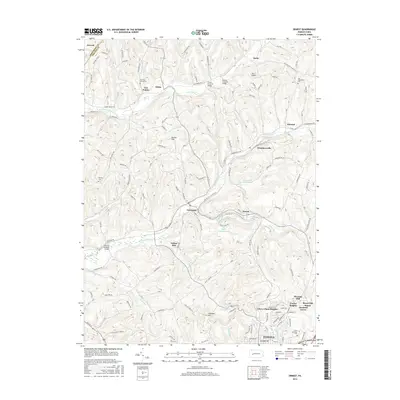
2016 Map of Ernest
USGS Topo · Published 2016About this map
The northern environs of Indiana are defined by the winding course of Crooked Creek and its many tributaries, such as South Branch Plum Creek and Fulton Run. This 2016 survey highlights a series of small, historic communities connected by winding rural roads, including Creekside, Ernest, and Chambersville. The area maintains significant connections to its past through well-preserved landmarks, most notably several historic spans such as the Trusal Covered Bridge and Hamon Covered Bridge over S Br Plum Cr, and the Thomas Covered Bridge further south.
Find a feature on this map
81 named features on this map. Tap any name to fly to it.
Don’t see what you’re looking for? This feature index may not catch every label — zoom into the map to look around manually.
Map Details
Editions of this 2016 Ernest Map
This is the sole edition of this map. No revisions or reprints were ever made.
Other maps of this area

1901 · Rural Valley
USGS Topo · 1:62,500

1902 · Indiana
USGS Topo · 1:62,500

1902 · Elders Ridge
USGS Topo · 1:62,500

1903 · Rural Valley
USGS Topo · 1:62,500

1904 · Elders Ridge
USGS Topo · 1:62,500

1909 · Smicksburg
USGS Topo · 1:62,500

1938 · Smicksburg
USGS Topo · 1:62,500

1939 · Smicksburg
USGS Topo · 1:62,500

1953 · Pittsburgh
USGS Topo · 1:250,000

1954 · Pittsburgh
USGS Topo · 1:250,000