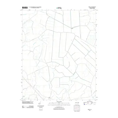
2010 Map of Ernul
USGS Topo · Published 2010About this map
Ernul and the nearby Cove Landing anchor this landscape in rural Craven County, where the topography is defined by an intricate network of wetlands. Significant drainages like Palmetto Swamp, Mauls Swamp, and Beaverdam Swamp dominate the terrain, illustrating the hydrological challenges and natural boundaries that shaped local development and road placement. The intersection of Old Brick Rd and Hudnell Rd serves as a central point for the small community of Ernul just north of where Beaverdam Swamp meets Fisher Swamp. To the north, Welbourn Airport provides a clear landmark among the drainage basins. The road names, including Brown Farm Rd and Willis Neck Rd, suggest long-standing family landholdings and agricultural roots in this coastal plain region.
Find a feature on this map
32 named features on this map. Tap any name to fly to it.
Don’t see what you’re looking for? This feature index may not catch every label — zoom into the map to look around manually.
Map Details
Editions of this 2010 Ernul Map
This is the sole edition of this map. No revisions or reprints were ever made.
Other maps of this area

1901 · New Bern
USGS Topo · 1:62,500

1902 · Vanceboro
USGS Topo · 1:62,500

1903 · New Bern
USGS Topo · 1:62,500

1904 · Vanceboro
USGS Topo · 1:62,500

1905 · Vanceboro
USGS Topo · 1:62,500

1950 · Edward
USGS Topo · 1:24,000

1951 · Hackney
USGS Topo · 1:24,000

1953 · Blounts Bay
USGS Topo · 1:24,000

1953 · Rocky Mount
USGS Topo · 1:250,000

1954 · Rocky Mount
USGS Topo · 1:250,000