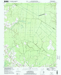
1998 Map of Ernul
USGS Topo · Published 2001About this map
Low-lying wetlands and thick evergreen shrub bogs dominate this coastal plain landscape along the border of Beaufort and Craven Counties. The sprawling Big Pocosin occupies much of the central and eastern terrain, intersected by drainage systems such as Palmetto Swamp, Mauls Swamp, and Beaverdam Swamp. These hydrologic patterns have historically shaped the human geography of the region, pushing settlements and agriculture to the better-drained margins.
Find a feature on this map
15 named features on this map. Tap any name to fly to it.
Don’t see what you’re looking for? This feature index may not catch every label — zoom into the map to look around manually.
Map Details
Editions of this 1998 Ernul Map
This is the sole edition of this map. No revisions or reprints were ever made.
Other maps of this area

1901 · New Bern
USGS Topo · 1:62,500

1902 · Vanceboro
USGS Topo · 1:62,500

1903 · New Bern
USGS Topo · 1:62,500

1904 · Vanceboro
USGS Topo · 1:62,500

1905 · Vanceboro
USGS Topo · 1:62,500

1950 · Edward
USGS Topo · 1:24,000

1951 · Hackney
USGS Topo · 1:24,000

1953 · Blounts Bay
USGS Topo · 1:24,000

1953 · Rocky Mount
USGS Topo · 1:250,000

1954 · Rocky Mount
USGS Topo · 1:250,000