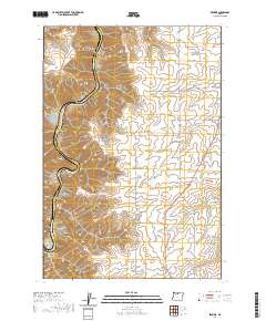
2020 Map of Erskine
USGS Topo · Published 2020About this map
The Deschutes River carves a deep path through this corner of Wasco County, defining the western edge of a landscape characterized by dramatic canyon systems and high ridges. The settlement of Erskine sits along the northern edge of Negro Ridge, serving as a central point in an area where local geography is marked by family names and descriptive landmarks like Harris Canyon, Macks Canyon, and Barnum Canyon. This modern survey illustrates how long-standing ranching and agricultural patterns persist in the rural Oregon interior.
Find a feature on this map
34 named features on this map. Tap any name to fly to it.
Don’t see what you’re looking for? This feature index may not catch every label — zoom into the map to look around manually.
Map Details
Editions of this 2020 Erskine Map
This is the sole edition of this map. No revisions or reprints were ever made.
Other maps of this area

1953 · The Dalles
USGS Topo · 1:250,000

1956 · The Dalles
USGS Topo · 1:250,000

1957 · The Dalles
USGS Topo · 1:250,000

1957 · Wasco
USGS Topo · 1:62,500

1957 · Wishram
USGS Topo · 1:62,500

1962 · Erskine
USGS Topo · 1:24,000

1962 · Summit Ridge
USGS Topo · 1:24,000

1962 · Sinamox
USGS Topo · 1:24,000

1962 · Grass Valley
USGS Topo · 1:24,000

1970 · Rosebush
USGS Topo · 1:24,000