2021 Map of Erwin
USGS Topo · Published 2021About this map
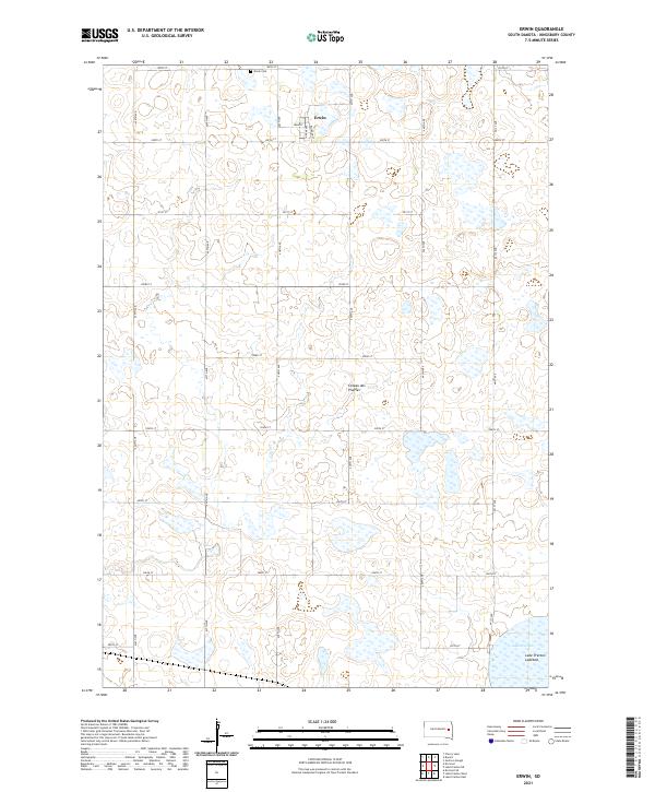
Erwin serves as the primary settlement on this portion of the Coteau des Prairies, a vast plateau that defines the regional topography. The village is organized around a grid including Main St, Adams Ave, and Railroad St, reflecting its historical reliance on transportation networks. To the northwest of the town center lies the Erwin Cem, an important site for genealogical research in this part of Kingsbury County. The surrounding landscape is characterized by a high concentration of wetlands and depressions typical of this glacial upland. In the southeast corner, the dry expanse of the Lake Preston Lakebed provides a clear indication of the area's fluctuating water levels, where former lake areas have transitioned into the marshy terrain and prairie flats shown in this modern survey.
Find a feature on this map
26 named features on this map. Tap any name to fly to it.
Don’t see what you’re looking for? This feature index may not catch every label — zoom into the map to look around manually.
Map Details
Editions of this 2021 Erwin Map
This is the sole edition of this map. No revisions or reprints were ever made.