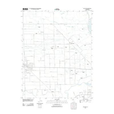
2012 Map of Escalon
USGS Topo · Published 2012About this map
The Stanislaus River defines the southern boundary of this agricultural corridor, where a complex network of irrigation channels supported the Central Valley's development. This survey reveals an intricate grid of laterals, such as the Thalheim Lateral, Cometa Lateral, and Reed Lateral, which redirected water from the Woodward Reservoir across the flat plains. Small clusters of settlement are visible at Valley Home and Cometa, while the surrounding landscape is marked by industrial agricultural operations like the Diamond H Dairy. For genealogists, the map identifies local resting places including Burwood Cem and Langworth Cem. Transportation across this region is anchored by the Escalon Airport and the historic path of Santa Fe Rd, reflecting the area's long-standing connection to both rail and river trade routes.
Find a feature on this map
122 named features on this map. Tap any name to fly to it.
Don’t see what you’re looking for? This feature index may not catch every label — zoom into the map to look around manually.
Map Details
Editions of this 2012 Escalon Map
This is the sole edition of this map. No revisions or reprints were ever made.
Other maps of this area

1914 · Avena
USGS Topo · 1:31,680

1915 · Oakdale
USGS Topo · 1:31,680

1915 · Trigo
USGS Topo · 1:31,680

1915 · Peters
USGS Topo · 1:31,680

1915 · Salida
USGS Topo · 1:31,680

1915 · Thalheim
USGS Topo · 1:31,680

1916 · Riverbank
USGS Topo · 1:31,680

1916 · Waterford
USGS Topo · 1:31,680

1916 · Bachelor Valley
USGS Topo · 1:31,680

1939 · Modesto East
USGS Topo · 1:62,500