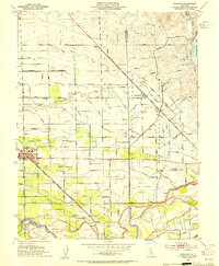
1953 Map of Escalon
USGS Topo · Published 1954About this map
Agricultural irrigation networks and transcontinental rail lines define the Central Valley landscape of Escalon in the early 1950s. The town serves as a hub where the Southern Pacific and the Atchison Topeka Santa Fe and railroads intersect, facilitating the movement of local produce. A dense grid of named roads like Henry Road and Grant Road connects outlying communities such as Valley Home and Cometa.
Find a feature on this map
77 named features on this map. Tap any name to fly to it.
Don’t see what you’re looking for? This feature index may not catch every label — zoom into the map to look around manually.
Map Details
Editions of this 1953 Escalon Map
This is the sole edition of this map. No revisions or reprints were ever made.
Other maps of this area

1914 · Avena
USGS Topo · 1:31,680

1915 · Oakdale
USGS Topo · 1:31,680

1915 · Trigo
USGS Topo · 1:31,680

1915 · Peters
USGS Topo · 1:31,680

1915 · Salida
USGS Topo · 1:31,680

1915 · Thalheim
USGS Topo · 1:31,680

1916 · Riverbank
USGS Topo · 1:31,680

1916 · Waterford
USGS Topo · 1:31,680

1916 · Bachelor Valley
USGS Topo · 1:31,680

1939 · Modesto East
USGS Topo · 1:62,500