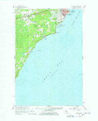
1958 Map of Escanaba
USGS Topo · Published 1978About this map
Escanaba serves as the focal point of this coastal survey, where the Chicago and North Western rail lines converge at the edge of Little Bay de Noc. The city's maritime and transportation infrastructure is well-defined, featuring the Sand Point Light, Escanaba Airport, and the large industrial footprint of the Chicago and North Western yards. To the south, the Ford River winds through its namesake township, passing the Ford River Sch and several community landmarks like the West Ford River Cem. The map reveals a transition from the urban density of the bayfront to the managed timberlands of the Bark River State Forest and the scattered rural settlements of Narenta and Pine Ridge. This document captures the mid-century industrial and recreational character of the Upper Peninsula, balancing the active port activities at Fishery Point with the secluded waters of Henderson Lakes.
Find a feature on this map
43 named features on this map. Tap any name to fly to it.
Don’t see what you’re looking for? This feature index may not catch every label — zoom into the map to look around manually.
Map Details
Editions of this 1958 Escanaba Map
2 editions found
Other maps of this area

1932 · Gladstone SE
USGS Topo · 1:31,680

1932 · Bark River NE
USGS Topo · 1:31,680

1932 · Whitney SE
USGS Topo · 1:31,680

1932 · Rapid River SW
USGS Topo · 1:31,680

1932 · Gladstone SW
USGS Topo · 1:31,680

1954 · Escanaba
USGS Topo · 1:250,000

1957 · Escanaba
USGS Topo · 1:250,000

1958 · Escanaba
USGS Topo · 1:250,000

1958 · Gladstone
USGS Topo · 1:62,500

1958 · Escanaba
USGS Topo · 1:62,500