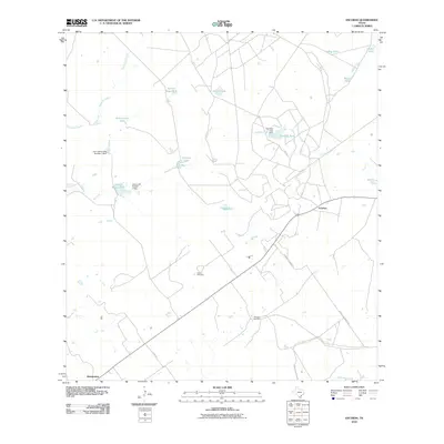
2010 Map of Escobas
USGS Topo · Published 2010About this map
Escobas and Bustamante anchor this rural Zapata County landscape, which is defined by an intricate network of tanks and seasonal watercourses vital to South Texas ranching. The terrain is marked by essential water management features such as Tom East Lake Escobas Creek Dam and Garza Lake Number 2 Dam, while dozens of smaller reservoirs like Rancho Viejo Tank, Negras Tank, and La Mota Tank suggest the area's agricultural and livestock priorities. Genealogical interest is centered on the Gracia Cemetery and Cameron Cemetery, which sit alongside the arterial Dorace Goodman Rd. The hydrology of the region is traced by the winding paths of Escobas Creek, Tejones Creek, and Taquache Creek, showing a landscape carefully managed for water retention in an arid environment.
Find a feature on this map
23 named features on this map. Tap any name to fly to it.
Don’t see what you’re looking for? This feature index may not catch every label — zoom into the map to look around manually.
Map Details
Editions of this 2010 Escobas Map
This is the sole edition of this map. No revisions or reprints were ever made.
Other maps of this area

1938 · Cuevitas
USGS Topo · 1:62,500

1939 · Randado
USGS Topo · 1:62,500

1940 · Randado
USGS Topo · 1:62,500

1940 · Mogotes Hill
USGS Topo · 1:62,500

1949 · Mc Allen
USGS Topo · 1:250,000

1954 · McAllen
USGS Topo · 1:250,000

1956 · Mogotes Hill
USGS Topo · 1:62,500

1956 · Arroyo Clareno
USGS Topo · 1:62,500

1956 · Laredo
USGS Topo · 1:250,000

1957 · Mc Allen
USGS Topo · 1:250,000