
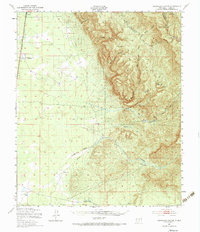
1950 Map of Escondido Canyon
USGS Topo · Published 1954About this map
Lincoln National Forest dominates the eastern half of this 1950s terrain, where the Sacramento Mountains drop sharply into the Tularosa Basin. The contrast between the high forest and the arid lowlands is marked by the presence of Sacramento City (Abandoned), an empty settlement site just east of the Southern Pacific tracks. Further north, Valmont sits along the rail line, while the deeper interior of the forest reveals isolated homesteads and landmarks like McCracken Ranch and the Sacramento Lookout Tower. The landscape is etched with complex drainage systems, including the massive Escondido Canyon and the winding Sacramento River. Evidence of early infrastructure persists in the western desert, with a prominent pipeline and aqueduct cutting across the flats near Pendejo Wash, supporting the ranching and railway operations of this Otero County region.
Find a feature on this map
41 named features on this map. Tap any name to fly to it.
Don’t see what you’re looking for? This feature index may not catch every label — zoom into the map to look around manually.
Map Details
Editions of this 1950 Escondido Canyon Map
2 editions found
Other maps of this area

1916 · Point Of Sands
USGS Topo · 1:125,000

1940 · Orogrande
USGS Topo · 1:62,500

1943 · Pendejo Wash
USGS Topo · 1:62,500

1943 · Orogrande
USGS Topo · 1:62,500

1947 · Orogrande North
USGS Topo · 1:24,000

1948 · Tres Hermanos
USGS Topo · 1:62,500

1948 · Holloman
USGS Topo · 1:62,500

1950 · Alamogordo
USGS Topo · 1:62,500

1952 · Cloudcroft
USGS Topo · 1:62,500

1954 · Carlsbad
USGS Topo · 1:250,000