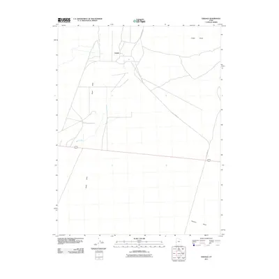
2011 Map of Eskdale
USGS Topo · Published 2011About this map
Eskdale sits as a primary point of human settlement within the expansive Great Basin landscape of Millard County. The community is positioned in the Snake Valley, a broad drainage basin where Baker Creek flows from the west. The local infrastructure is characterized by a grid of rural roads and the prominent path of Knoll Springs Rd, which cuts across the arid basin towards the northeast. To the east and south, the terrain transitions into the desolate stretches of the Ferguson Desert and the rising elevations of the Conger Range. This 2011 survey captures the area's agricultural and residential layout, reflecting the sparse but deliberate development typical of this remote high-desert region on the Utah-Nevada border.
Find a feature on this map
6 named features on this map. Tap any name to fly to it.
Don’t see what you’re looking for? This feature index may not catch every label — zoom into the map to look around manually.
Map Details
Editions of this 2011 Eskdale Map
This is the sole edition of this map. No revisions or reprints were ever made.
Other maps of this area

1908 · Fish Springs
USGS Topo · 1:250,000

1910 · Fish Springs
USGS Topo · 1:250,000

1949 · Garrison
USGS Topo · 1:62,500

1951 · Garrison
USGS Topo · 1:62,500

1953 · Richfield
USGS Topo · 1:250,000

1953 · Delta
USGS Topo · 1:250,000

1956 · Lund
USGS Topo · 1:250,000

1956 · Ely
USGS Topo · 1:250,000

1958 · Richfield
USGS Topo · 1:250,000

1958 · Delta
USGS Topo · 1:250,000