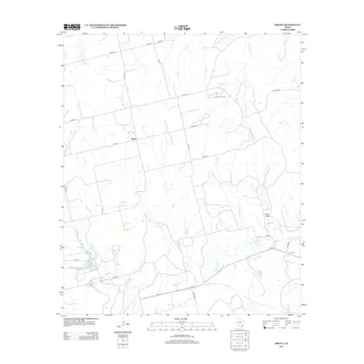
2012 Map of Eskota
USGS Topo · Published 2012About this map
The settlement of Palava and the industrial activity of the Newman Oil Field characterize this portion of Fisher County, Texas, as it appeared in the early 21st century. The landscape is defined by an intricate network of drainage systems, including the headwaters of Sweetwater Cr, Raven Crk, and Bitter Cr. These waterways carve through the terrain, notably at Horse Hollow and along the course of Bluff Cr.
Find a feature on this map
33 named features on this map. Tap any name to fly to it.
Don’t see what you’re looking for? This feature index may not catch every label — zoom into the map to look around manually.
Map Details
Editions of this 2012 Eskota Map
This is the sole edition of this map. No revisions or reprints were ever made.
Other maps of this area
1893 · Roby
USGS Topo · 1:125,000
1893 · Sweetwater
USGS Topo · 1:125,000
1954 · Big Spring
USGS Topo · 1:250,000
1957 · Merkel
USGS Topo · 1:62,500
1957 · Noodle
USGS Topo · 1:62,500
1958 · Big Spring
USGS Topo · 1:250,000
1969 · Busby
USGS Topo · 1:24,000
1969 · Roby
USGS Topo · 1:24,000
1969 · Eskota
USGS Topo · 1:24,000
1969 · Sweetwater
USGS Topo · 1:24,000