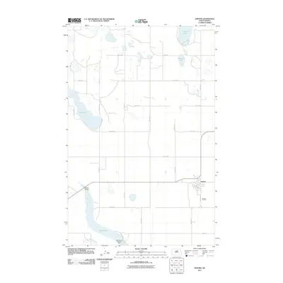
2011 Map of Esmond
USGS Topo · Published 2011About this map
Esmond stands as the primary settlement in this corner of Benson County, situated where the grid of sections meets the local rail-aligned streets of 1st St South and Bernice Ave S. The town's surrounding landscape is defined by the prairie potholes and glacial depressions characteristic of the region, including Cranberry Lake, Roberts Lake, and the elongated basin of Long Lake. This 2011 survey captures the area's modern water management infrastructure, most notably the Buffalo Lake Diversion Dam located at the southern edge near the North Fork Sheyenne River. To the west, the winding Buffalo Coulee feeds into the larger Buffalo Lake, illustrating the complex drainage patterns of the North Dakota plains. For local historians and genealogists, the Esmond Cemetery south of town provides a key point for tracing family heritage within the township.
Find a feature on this map
26 named features on this map. Tap any name to fly to it.
Don’t see what you’re looking for? This feature index may not catch every label — zoom into the map to look around manually.
Map Details
Editions of this 2011 Esmond Map
This is the sole edition of this map. No revisions or reprints were ever made.
Other maps of this area

1941 · Selz
USGS Topo · 1:62,500

1943 · Maddock
USGS Topo · 1:62,500

1945 · Maddock
USGS Topo · 1:62,500

1951 · Selz NE
USGS Topo · 1:24,000

1951 · Selz NW
USGS Topo · 1:24,000

1951 · Hesper
USGS Topo · 1:24,000

1952 · New Rockford
USGS Topo · 1:250,000

1953 · Devils Lake
USGS Topo · 1:250,000

1956 · New Rockford
USGS Topo · 1:250,000

1956 · Devils Lake
USGS Topo · 1:250,000