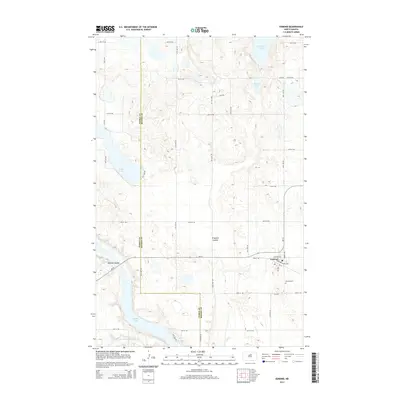
2014 Map of Esmond
USGS Topo · Published 2014About this map
Esmond serves as the primary hub of activity in this section of the prairie, located at the intersection of ND-19 and Bernice Ave. The town’s grid is anchored by the legacy of rail transport along Northern Pacific Ave, while the local Esmond Cem lies just to the southeast. The landscape is defined by the glacial pothole geography of the northern plains, featuring numerous bodies of water such as Cranberry Lake, Roberts Lake, and the larger Long Lake to the west. To the south, the terrain descends toward the N Fork Sheyenne River, which meanders through a valley also shaped by Buffalo Coulee and Buffalo Lake. The county line between Pierce Co and Benson Co bisects the western half of the map, illustrating how early political boundaries were laid over this water-dotted terrain of coulees and prairie lakes.
Find a feature on this map
34 named features on this map. Tap any name to fly to it.
Don’t see what you’re looking for? This feature index may not catch every label — zoom into the map to look around manually.
Map Details
Editions of this 2014 Esmond Map
This is the sole edition of this map. No revisions or reprints were ever made.
Other maps of this area

1941 · Selz
USGS Topo · 1:62,500

1943 · Maddock
USGS Topo · 1:62,500

1945 · Maddock
USGS Topo · 1:62,500

1951 · Selz NE
USGS Topo · 1:24,000

1951 · Selz NW
USGS Topo · 1:24,000

1951 · Hesper
USGS Topo · 1:24,000

1952 · New Rockford
USGS Topo · 1:250,000

1953 · Devils Lake
USGS Topo · 1:250,000

1956 · New Rockford
USGS Topo · 1:250,000

1956 · Devils Lake
USGS Topo · 1:250,000