2024 Map of Esmond
USGS Topo · Published 2024About this map
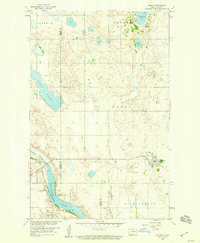
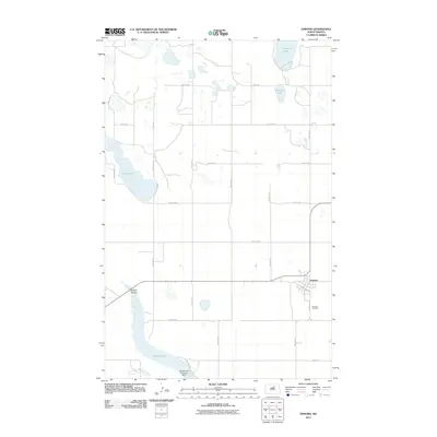
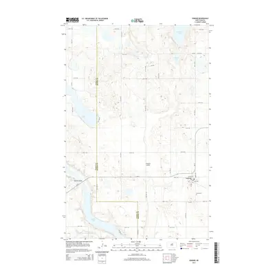
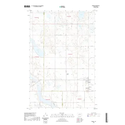
Esmond stands at the intersection of local history and the sprawling wetlands of the central North Dakota prairie. This 2024 edition documents the settlement and its surrounding agricultural landscape, where the town site is anchored by its community heritage at Trinity Lutheran Cem, Saint Boniface Catholic Cem, and Rosehill Cem. The topography is defined by the prairie pothole region, featuring numerous water bodies like Cranberry Lake, Roberts Lake, and Long Lake. To the west, the Buffalo Lake National Wildlife Refuge preserves the natural character of the terrain, which is further shaped by the winding Buffalo Coulee and Trappers Coulee. In the south, the North Fork Sheyenne River cuts across the border of Pierce and Benson Counties, illustrating the drainage patterns that have influenced land use in this region for generations.
Find a feature on this map
30 named features on this map. Tap any name to fly to it.
Don’t see what you’re looking for? This feature index may not catch every label — zoom into the map to look around manually.
Map Details
Editions of this 2024 Esmond Map
This is the sole edition of this map. No revisions or reprints were ever made.
Historical Maps of Esmond Through Time
6 maps found