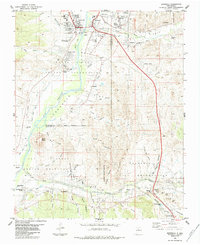
1984 Map of Espanola
USGS Topo · Published 1984About this map
The Rio Grande flows through this 1984 survey, serving as a corridor for established communities and indigenous lands in Northern New Mexico. The map details the intricate relationship between water and settlement in the high desert, documenting vital irrigation infrastructure like the Vigil Ditch, La Mesilla Ditch, and Llano Ditch. These canals branch off the Santa Cruz River and other tributaries to support the agricultural heritage of the Santa Clara Indian Reservation and the San Ildefonso Indian Reservation. Distinctive landforms such as the prominent Black Mesa rise above the valley floor, while the growing urban center of Espanola anchors the northern portion of the sheet. For genealogists and local historians, the map provides a precise look at the small clusters of homes and family plots in Santo Niño, Riverside, and La Mesilla, alongside the historic centers of Santa Clara Pueblo and San Ildefonso Pueblo.
Find a feature on this map
61 named features on this map. Tap any name to fly to it.
Don’t see what you’re looking for? This feature index may not catch every label — zoom into the map to look around manually.
Map Details
Editions of this 1984 Espanola Map
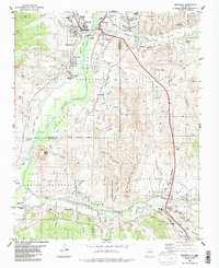
2 editions found
Other maps of this area

1889 · Santa Fe
USGS Topo · 1:125,000

1892 · Santa Clara
USGS Topo · 1:125,000

1894 · Santa Fe
USGS Topo · 1:125,000

1918 · Abiquiu
USGS Topo · 1:125,000

1952 · White Rock
USGS Topo · 1:24,000

1952 · Puye
USGS Topo · 1:24,000

1953 · Tesuque
USGS Topo · 1:24,000

1953 · Espanola
USGS Topo · 1:24,000

1953 · Chili
USGS Topo · 1:24,000

1953 · San Juan Pueblo
USGS Topo · 1:24,000