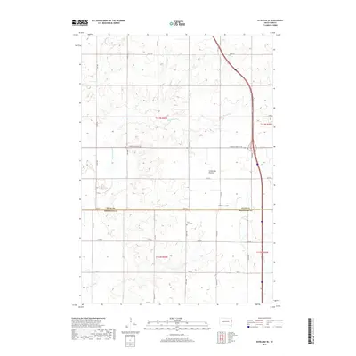
2017 Map of Estelline SE
USGS Topo · Published 2017About this map
Johnsonville sits at the intersection of local township roads and the Deuel and Brookings County line, characterizing the grid-based settlement of the Coteau des Prairies plateau. This upland landscape is defined by its subtle drainage patterns, where small waterways like Peg Munky Run and Bullhead Run wind through the prairie towards the Big Sioux River in the southwestern corner. The presence of Saint Johns Cem near the center of the sheet reflects the deep-rooted community history of the area, typical of eastern South Dakota agricultural life. The map shows the region's reliance on a well-ordered transportation network, ranging from rural gravel routes like 467th Ave to the more significant S Dakota Highway 28, which facilitates movement across this elevated highland region.
Find a feature on this map
30 named features on this map. Tap any name to fly to it.
Don’t see what you’re looking for? This feature index may not catch every label — zoom into the map to look around manually.
Map Details
Editions of this 2017 Estelline SE Map
This is the sole edition of this map. No revisions or reprints were ever made.
Other maps of this area

1953 · Watertown
USGS Topo · 1:250,000

1958 · Watertown
USGS Topo · 1:250,000

1968 · Brookings NE
USGS Topo · 1:24,000

1968 · Bruce
USGS Topo · 1:24,000

1969 · Dempster
USGS Topo · 1:24,000

1970 · White
USGS Topo · 1:24,000

1970 · Clear Lake South
USGS Topo · 1:24,000

1970 · Estelline SE
USGS Topo · 1:24,000

1970 · Estelline
USGS Topo · 1:24,000

1970 · Estelline NE
USGS Topo · 1:24,000