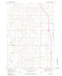
1970 Map of Estelline SE
USGS Topo · Published 1982About this map
Agricultural lands along the border of Deuel and Brookings counties are meticulously detailed in this survey, showcasing the rural layout of eastern South Dakota. The landscape is defined by the drainage systems of Munky Run, Peg Run, and the North Fork Deer Creek, which eventually feed toward the Big Sioux River in the southwestern corner. Social and civic life in the late twentieth century centered on landmarks like the local Townhall, the St John Cem, and the small settlement of Johnsonville.
Find a feature on this map
16 named features on this map. Tap any name to fly to it.
Don’t see what you’re looking for? This feature index may not catch every label — zoom into the map to look around manually.
Map Details
Editions of this 1970 Estelline SE Map
2 editions found
Other maps of this area

1953 · Watertown
USGS Topo · 1:250,000

1958 · Watertown
USGS Topo · 1:250,000

1968 · Brookings NE
USGS Topo · 1:24,000

1968 · Bruce
USGS Topo · 1:24,000

1969 · Dempster
USGS Topo · 1:24,000

1970 · White
USGS Topo · 1:24,000

1970 · Clear Lake South
USGS Topo · 1:24,000

1970 · Estelline SE
USGS Topo · 1:24,000

1970 · Estelline
USGS Topo · 1:24,000

1970 · Estelline NE
USGS Topo · 1:24,000