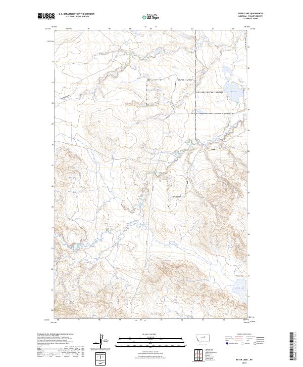
2024 Map of Ester Lake
USGS Topo · Published 2024About this map
Big Warm Creek meanders through this portion of Phillips County, carving a distinct drainage pattern across the high plains. The landscape is defined by its intermittent water sources and expansive terrain, where the waters of Ester Lake and the smaller Parrot Lake provide rare catchments in an otherwise arid environment. This 2024 edition captures the modern infrastructure of the region, anchored by the passage of Hwy 204 and Rte 11, which follow the natural contours of the land. The presence of Parrot Flat and Spring Coulee highlights the traditional geographical markers used by ranchers and locals to navigate this sparsely populated section of Montana. The map provides a precise look at the township and range divisions, such as t27n r27e, illustrating the enduring grid system that governs land ownership in the American West.
Find a feature on this map
11 named features on this map. Tap any name to fly to it.
Don’t see what you’re looking for? This feature index may not catch every label — zoom into the map to look around manually.
Map Details
Editions of this 2024 Ester Lake Map
This is the sole edition of this map. No revisions or reprints were ever made.
Other maps of this area

1953 · Havre
USGS Topo · 1:250,000

1954 · Lewistown
USGS Topo · 1:250,000

1957 · Havre
USGS Topo · 1:250,000

1958 · Havre
USGS Topo · 1:250,000

1959 · Lewistown
USGS Topo · 1:250,000

1965 · Veseth Reservoir
USGS Topo · 1:24,000

1965 · Phillips
USGS Topo · 1:24,000

1965 · Wild Horse Reservoir
USGS Topo · 1:24,000

1971 · Big Flat East
USGS Topo · 1:24,000

1971 · Bear Mountain
USGS Topo · 1:24,000