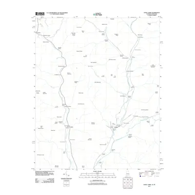
2011 Map of Estill Fork
USGS Topo · Published 2011About this map
Francisco, Estillfork, and Larkin are the primary settlements in this rural corner of the Alabama-Tennessee border. The landscape is defined by the headwaters of the Paint Rock River, where the Larkin Fork and Estill Fork waterways carve deep through the plateau. Local history is anchored in several dozen family-named burial grounds, such as Posey Cemetery, Butler Cemetery, and Old Grays Cemetery, which trace the lineage of early homesteaders across the hollows. Distinctive terrain features like Backbone Ridge, The Narrows, and Larkin Mountain separate the various coves and hollows, illustrating a classic Appalachian settlement pattern where roads and communities are dictated by the underlying topography. The map also records essential transit points for the local rural economy, including Freedom Bridge and numerous gaps and coves that have historically connected these isolated upland valleys.
Find a feature on this map
103 named features on this map. Tap any name to fly to it.
Don’t see what you’re looking for? This feature index may not catch every label — zoom into the map to look around manually.
Map Details
Editions of this 2011 Estill Fork Map
This is the sole edition of this map. No revisions or reprints were ever made.
Other maps of this area

1888 · Scottsboro
USGS Topo · 1:125,000

1892 · Scottsboro
USGS Topo · 1:125,000

1928 · Decherd
USGS Topo · 1:62,500

1936 · King Cove
USGS Topo · 1:24,000

1936 · Hollytree
USGS Topo · 1:24,000

1936 · Beans Creek
USGS Topo · 1:24,000

1936 · Mud Creek
USGS Topo · 1:24,000

1936 · Hytop
USGS Topo · 1:24,000

1936 · Princeton
USGS Topo · 1:24,000

1936 · Huntland
USGS Topo · 1:24,000