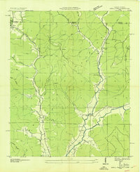
1939 Map of Estill Fork
USGS Topo · Published 1939About this map
The Cumberland Plateau landscape along the Alabama-Tennessee state line is captured here through the detailed work of Arthur E. Morgan and the Tennessee Valley Authority. The settlement pattern follows the narrow valley floors, most notably along the Larkin Fork and Estill Fork of the Paint Rock River. These drainages are flanked by significant elevations like Miller Mountain and Little Mountain, creating a topography where local life centered on small, dispersed communities.
Find a feature on this map
70 named features on this map. Tap any name to fly to it.
Don’t see what you’re looking for? This feature index may not catch every label — zoom into the map to look around manually.
Map Details
Editions of this 1939 Estill Fork Map
This is the sole edition of this map. No revisions or reprints were ever made.
Other maps of this area

1888 · Scottsboro
USGS Topo · 1:125,000

1892 · Scottsboro
USGS Topo · 1:125,000

1928 · Decherd
USGS Topo · 1:62,500

1936 · King Cove
USGS Topo · 1:24,000

1936 · Hollytree
USGS Topo · 1:24,000

1936 · Beans Creek
USGS Topo · 1:24,000

1936 · Mud Creek
USGS Topo · 1:24,000

1936 · Hytop
USGS Topo · 1:24,000

1936 · Princeton
USGS Topo · 1:24,000

1936 · Huntland
USGS Topo · 1:24,000