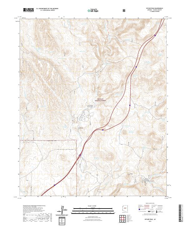
2021 Map of Estler Peak
USGS Topo · Published 2021About this map
Prescott National Forest dominates the high-desert terrain of central Arizona, where an intricate network of washes and canyons defines the drainage of the Agua Fria basin. This 2021 survey illustrates a landscape primarily managed for ranching and conservation, marked by numerous water developments including Burro Tank, Metate Tank, and Fence Tank. These features reflect the area's ongoing importance for livestock management in an arid climate. Historical access points and early transportation corridors are preserved in the alignments of Orme Rd and Dugas Rd, which wind through the topographical relief of Long Ridge. Higher elevations are anchored by Estler Peak, providing a clear view of the complex hydrography comprising Ash Cr and its tributaries. The proximity of Government Spring and Sheen Spring indicates the vital reliable water sources that have supported local activity for generations.
Find a feature on this map
46 named features on this map. Tap any name to fly to it.
Don’t see what you’re looking for? This feature index may not catch every label — zoom into the map to look around manually.
Map Details
Editions of this 2021 Estler Peak Map
This is the sole edition of this map. No revisions or reprints were ever made.
Other maps of this area

1887 · Verde
USGS Topo · 1:250,000

1887 · Prescott
USGS Topo · 1:250,000

1892 · Verde
USGS Topo · 1:250,000

1892 · Prescott
USGS Topo · 1:250,000

1903 · Bradshaw Mountains
USGS Topo · 1:125,000

1905 · Jerome
USGS Topo · 1:125,000

1923 · Camp Verde
USGS Topo · 1:125,000

1929 · Turret Peak
USGS Topo · 1:125,000

1932 · Camp Verde
USGS Topo · 1:125,000

1933 · Turret Peak
USGS Topo · 1:125,000