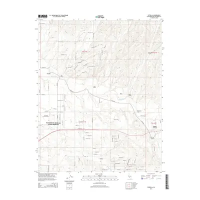
2015 Map of Estrella
USGS Topo · Published 2015About this map
The Estrella River winds through this Central Coast landscape, carving a wide valley that defines the local geography between El Paso De Robles (Paso Robles) and the smaller community of Whitley Gardens. This region is characterized by deep canyons such as Keyes Canyon and Mason Canyon that feed into the river system. The settlement pattern reflects the agricultural and aviation importance of the area, with the Paso Robles Municipal Airport and the smaller Bonel Airport serving as key landmarks.
Find a feature on this map
88 named features on this map. Tap any name to fly to it.
Don’t see what you’re looking for? This feature index may not catch every label — zoom into the map to look around manually.
Map Details
Editions of this 2015 Estrella Map
This is the sole edition of this map. No revisions or reprints were ever made.
Other maps of this area

1914 · Cholame
USGS Topo · 1:125,000

1915 · Cholame
USGS Topo · 1:125,000

1917 · Cholame
USGS Topo · 1:125,000

1919 · San Miguel
USGS Topo · 1:62,500

1919 · Paso Robles
USGS Topo · 1:62,500

1943 · Shandon
USGS Topo · 1:31,680

1943 · Paso Robles
USGS Topo · 1:62,500

1943 · Shedd Canyon
USGS Topo · 1:31,680
1943 · Cholame Hills
USGS Topo · 1:31,680

1947 · San Luis Obispo
USGS Topo · 1:250,000