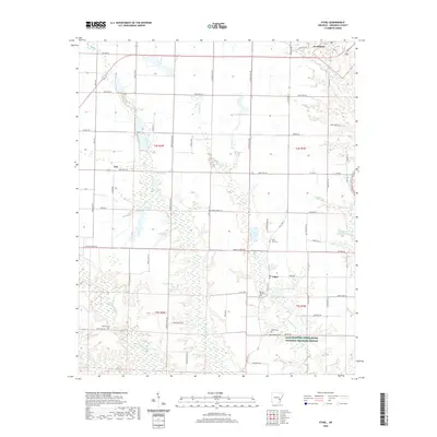
2020 Map of Ethel
USGS Topo · Published 2020About this map
St. Charles anchors the northern reaches of this Arkansas County landscape, where the terrestrial terrain meets the intricate wetland systems of the Dale Bumpers White River National Wildlife Refuge. The map reveals a region defined by its hydrography, with La Grue Bayou and Tarleton Creek threading through a patchwork of agricultural fields and lowland basins. Small rural hubs like Ethel and Van provide local context for researchers, while the placement of numerous family and community burial sites, including Saint John Cemetery, Mount Pleasant Cemetery, and the McEwen Cemetery, offer significant value for genealogical study. The presence of varied water bodies such as Lake Rosebud, Otis Pond, and Butler Lake illustrates the seasonal and permanent water cycles that dictate the rhythm of life and land use in this river-adjacent territory.
Find a feature on this map
74 named features on this map. Tap any name to fly to it.
Don’t see what you’re looking for? This feature index may not catch every label — zoom into the map to look around manually.
Map Details
Editions of this 2020 Ethel Map
This is the sole edition of this map. No revisions or reprints were ever made.
Other maps of this area

1935 · Gillett
USGS Topo · 1:62,500

1939 · Indian Bay
USGS Topo · 1:62,500

1939 · Henrico
USGS Topo · 1:62,500

1941 · De Witt
USGS Topo · 1:62,500

1948 · Helena
USGS Topo · 1:250,000

1950 · Helena
USGS Topo · 1:250,000

1954 · Indian Bay
USGS Topo · 1:62,500

1954 · De Witt
USGS Topo · 1:62,500

1954 · Henrico
USGS Topo · 1:62,500

1955 · Helena
USGS Topo · 1:250,000