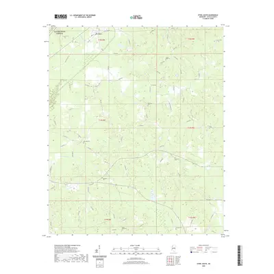
2020 Map of Ethel South
USGS Topo · Published 2020About this map
Ethel sits at the northern edge of this survey, where the Natchez Trace Parkway cuts across the northwest corner, marking a corridor of deep historical significance in Attala County. The landscape is defined by the winding course of the Yockanookany River and its numerous tributaries, including Turkey Creek, Cowpen Creek, and Conehoma Creek. This network of waterways creates a fragmented topography of ridges and lowlands, historically shaping the settlement patterns of this rural Mississippi region.
Find a feature on this map
76 named features on this map. Tap any name to fly to it.
Don’t see what you’re looking for? This feature index may not catch every label — zoom into the map to look around manually.
Map Details
Editions of this 2020 Ethel South Map
This is the sole edition of this map. No revisions or reprints were ever made.
Other maps of this area

1953 · Meridian
USGS Topo · 1:250,000

1953 · West Point
USGS Topo · 1:250,000

1957 · Meridian
USGS Topo · 1:250,000

1958 · West Point
USGS Topo · 1:250,000

1962 · Edinburg
USGS Topo · 1:62,500

1962 · Thomastown
USGS Topo · 1:62,500

1963 · West Point
USGS Topo · 1:250,000

1964 · Kosciusko NE
USGS Topo · 1:24,000

1964 · Kosciusko
USGS Topo · 1:24,000

1965 · Meridian
USGS Topo · 1:250,000