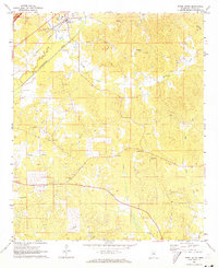
1972 Map of Ethel South
USGS Topo · Published 1973About this map
The town of Ethel anchors the northern edge of this 1970s survey, situated along the Illinois Central railroad line and the winding Yockanookany River. The landscape is defined by its rural community structures and significant extractive activity, with numerous sandpits and a gravel pit scattered across the undulating terrain. A dense network of local creeks, including Turkey Creek, Kyle Creek, and Cowpen Creek, drains the region, while a modern pipeline and the Natchez Trace Parkway cut across the established local topography.
Find a feature on this map
26 named features on this map. Tap any name to fly to it.
Don’t see what you’re looking for? This feature index may not catch every label — zoom into the map to look around manually.
Map Details
Editions of this 1972 Ethel South Map
This is the sole edition of this map. No revisions or reprints were ever made.
Other maps of this area

1953 · Meridian
USGS Topo · 1:250,000

1953 · West Point
USGS Topo · 1:250,000

1957 · Meridian
USGS Topo · 1:250,000

1958 · West Point
USGS Topo · 1:250,000

1962 · Edinburg
USGS Topo · 1:62,500

1962 · Thomastown
USGS Topo · 1:62,500

1963 · West Point
USGS Topo · 1:250,000

1964 · Kosciusko NE
USGS Topo · 1:24,000

1964 · Kosciusko
USGS Topo · 1:24,000

1965 · Meridian
USGS Topo · 1:250,000