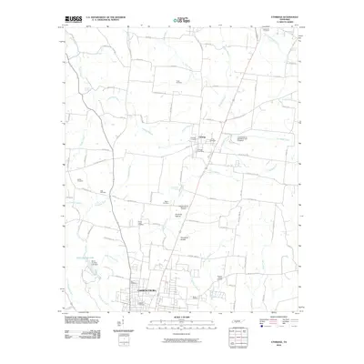
2010 Map of Ethridge
USGS Topo · Published 2010About this map
Ethridge and the northern outskirts of Lawrenceburg define this central Lawrence County landscape, where the plateau begins to drop into creek-cut valleys. The area is marked by a high density of family and community burial grounds, including the Ethridge Cemetery, Zion Cemetery, and Mount Ararat Cemetery, which serve as vital landmarks for genealogical research in this part of Tennessee. To the south, David Crockett State Park encompasses the waters of David Crockett Lake, created by the David Crockett Lake Dam. The map also captures local recreation and historical infrastructure, from the Lawrenceburg Speedway and Dragstrip east of town to the Old County Farm Spring. Flowing through the terrain are the headwaters of the Buffalo River and Little Shoal Creek, following a drainage pattern that has influenced local road placement for generations.
Find a feature on this map
100 named features on this map. Tap any name to fly to it.
Don’t see what you’re looking for? This feature index may not catch every label — zoom into the map to look around manually.
Map Details
Editions of this 2010 Ethridge Map
This is the sole edition of this map. No revisions or reprints were ever made.
Other maps of this area

1936 · Sandy Hook
USGS Topo · 1:24,000

1936 · Deerfield
USGS Topo · 1:24,000

1936 · Henryville
USGS Topo · 1:24,000

1936 · Campbellsville
USGS Topo · 1:24,000

1936 · Lawrenceburg
USGS Topo · 1:24,000

1936 · Ethridge
USGS Topo · 1:24,000

1936 · Long Branch
USGS Topo · 1:24,000

1936 · Crestview
USGS Topo · 1:24,000

1936 · Bodenham
USGS Topo · 1:24,000

1948 · Bodenham
USGS Topo · 1:24,000