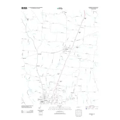
2013 Map of Ethridge
USGS Topo · Published 2013About this map
Ethridge serves as the central hub of this Lawrence County landscape, situated where the terrain transitions toward the watercourses of the Buffalo River and Shoal Cr. The map documents a blend of established residential areas like Belmont, Meadowview, and Clearview Heights alongside significant recreation and sporting landmarks. The southern portion is defined by the expanse of David Crockett State Park and David Crockett Lake, while the local racing culture is anchored by the Lawrenceburg Speedway and Dragstrip. Smaller, older rural nodes such as Brace, Webber City, and Mars Hill are scattered throughout the region, connected by a network of family-named routes like Bud Taylor Rd and Brooks Hughes Rd. Notable hydraulic features, including Old County Farm Spring and Staggs Spring, highlight the importance of natural water sources to the area's development and topography.
Find a feature on this map
197 named features on this map. Tap any name to fly to it.
Don’t see what you’re looking for? This feature index may not catch every label — zoom into the map to look around manually.
Map Details
Editions of this 2013 Ethridge Map
This is the sole edition of this map. No revisions or reprints were ever made.
Other maps of this area

1936 · Sandy Hook
USGS Topo · 1:24,000

1936 · Deerfield
USGS Topo · 1:24,000

1936 · Henryville
USGS Topo · 1:24,000

1936 · Campbellsville
USGS Topo · 1:24,000

1936 · Lawrenceburg
USGS Topo · 1:24,000

1936 · Ethridge
USGS Topo · 1:24,000

1936 · Long Branch
USGS Topo · 1:24,000

1936 · Crestview
USGS Topo · 1:24,000

1936 · Bodenham
USGS Topo · 1:24,000

1948 · Bodenham
USGS Topo · 1:24,000