2023 Map of Etna
USGS Topo · Published 2023About this map
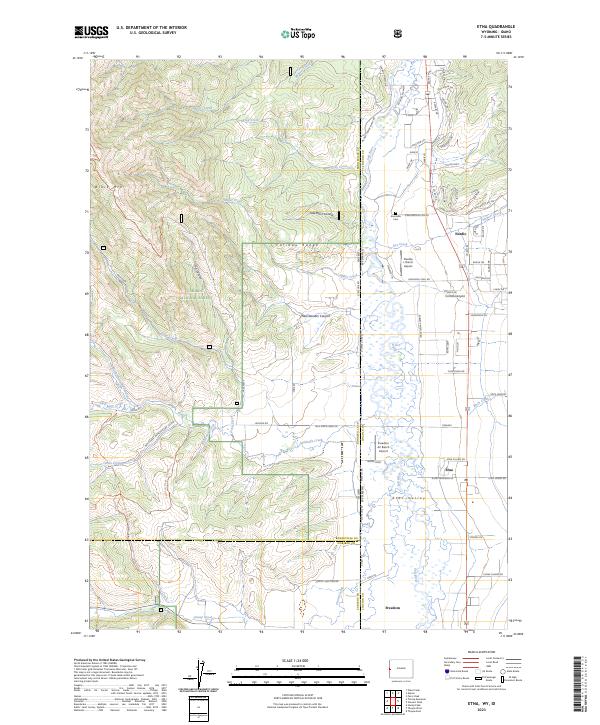
Star Valley dominates the eastern half of this landscape, where the Salt River meanders north through a complex of wetlands and ranch lands. The Idaho-Wyoming state line bisects the area vertically, creating a distinct border between the high peaks of the Caribou Range to the west and the valley floor to the east. Modern rural development is centered around Etna and the northern edge of Freedom, with a network of residential roads like Etna Village Dr and Good Neighbor Ln signaling recent growth near the mountains.
Find a feature on this map
100 named features on this map. Tap any name to fly to it.
Don’t see what you’re looking for? This feature index may not catch every label — zoom into the map to look around manually.
Map Details
Editions of this 2023 Etna Map
This is the sole edition of this map. No revisions or reprints were ever made.