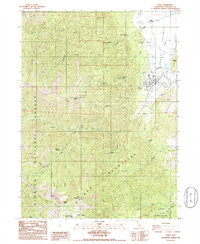
1986 Map of Etna
USGS Topo · Published 1986About this map
The town of Etna sits at the western edge of the Scott Valley, serving as a gateway between the valley's ranching operations and the high ridges of the Salmon Mountains. This mid-1980s landscape reveals the intersection of irrigation and wilderness, where numerous wells and sewage disposal ponds near the settlement give way to the protected heights of the Klamath National Forest. Researchers will find notable family-named sites such as the Deacon Lee Place and natural features like Hughes Hill, which overlook the complex drainage systems of Patterson Creek and Crystal Creek.
Find a feature on this map
43 named features on this map. Tap any name to fly to it.
Don’t see what you’re looking for? This feature index may not catch every label — zoom into the map to look around manually.
Map Details
Editions of this 1986 Etna Map
This is the sole edition of this map. No revisions or reprints were ever made.
Other maps of this area

1886 · Shasta
USGS Topo · 1:250,000

1894 · Shasta
USGS Topo · 1:250,000

1914 · Seiad
USGS Topo · 1:125,000

1922 · Seiad
USGS Topo · 1:125,000

1923 · Sawyers Bar
USGS Topo · 1:125,000

1931 · Etna
USGS Topo · 1:96,000

1932 · Yreka
USGS Topo · 1:96,000

1934 · Etna
USGS Topo · 1:125,000

1939 · Yreka
USGS Topo · 1:125,000

1948 · Weed
USGS Topo · 1:250,000