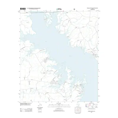
2013 Map of Etoile South
USGS Topo · Published 2013About this map
Sam Rayburn Reservoir dominates the landscape of this East Texas survey, its intricate shoreline carving into the piney woods of Angelina and Nacogdoches counties. Small settlements like Ora and Shirley Creek are connected by a network of winding roads, including FM-2109 and Sam Nerren Rd. The map is particularly dense with genealogical markers, noting numerous family burial grounds such as Baron Cem, Shofer Cem, and Cochran Cem. These sites, along with the Etoile Lookout and the Hanks Creek Park Campground, suggest a region defined by its relationship with the water and a deep-seated local history. The transition from established rural communities to recreational lakefront is evident in the residential developments near Shirley Creek and the wooded tracts of the Carter Farm Hunt Club Rd.
Find a feature on this map
77 named features on this map. Tap any name to fly to it.
Don’t see what you’re looking for? This feature index may not catch every label — zoom into the map to look around manually.
Map Details
Editions of this 2013 Etoile South Map
This is the sole edition of this map. No revisions or reprints were ever made.
Other maps of this area

1931 · Zavalla
USGS Topo · 1:62,500

1932 · Manning
USGS Topo · 1:62,500

1949 · Lufkin
USGS Topo · 1:62,500

1949 · Platt
USGS Topo · 1:24,000

1949 · Huntington
USGS Topo · 1:24,000

1950 · Platt
USGS Topo · 1:24,000

1950 · Huntington
USGS Topo · 1:24,000

1953 · Palestine
USGS Topo · 1:250,000

1957 · Palestine
USGS Topo · 1:250,000

1958 · Zavalla
USGS Topo · 1:62,500