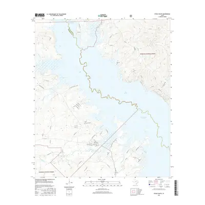
2016 Map of Etoile South
USGS Topo · Published 2016About this map
Sam Rayburn Reservoir dominates this East Texas landscape, where the waters branch into deep inlets and coves along the boundary of Nacogdoches and Angelina counties. The eastern portion of the map is defined by the protected timberlands of the Angelina National Forest, a terrain of creeks like Beech Cr and Shirley Cr that feed into the reservoir's main body. For genealogists and local historians, this survey preserves the locations of numerous family and community burial grounds, including the Patterson Cem and Blue Spring Cem near Blue Spring. The southern half shows an intricate network of rural roads such as Lloyd Walker Rd and Palmer Ivy Rd, serving small residential clusters and recreational developments like Beachwood Blvd that line the jagged shoreline of the Big Slough.
Find a feature on this map
66 named features on this map. Tap any name to fly to it.
Don’t see what you’re looking for? This feature index may not catch every label — zoom into the map to look around manually.
Map Details
Editions of this 2016 Etoile South Map
This is the sole edition of this map. No revisions or reprints were ever made.
Other maps of this area

1931 · Zavalla
USGS Topo · 1:62,500

1932 · Manning
USGS Topo · 1:62,500

1949 · Lufkin
USGS Topo · 1:62,500

1949 · Platt
USGS Topo · 1:24,000

1949 · Huntington
USGS Topo · 1:24,000

1950 · Platt
USGS Topo · 1:24,000

1950 · Huntington
USGS Topo · 1:24,000

1953 · Palestine
USGS Topo · 1:250,000

1957 · Palestine
USGS Topo · 1:250,000

1958 · Zavalla
USGS Topo · 1:62,500