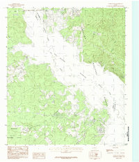
1984 Map of Etoile South
USGS Topo · Published 1984About this map
Sam Rayburn Reservoir dominates this East Texas landscape, where the waters of the Angelina River meet the heavily wooded expanses of the Angelina National Forest. The map shows a region of dense creek networks and small, scattered settlements such as Etoile, Ora, and Nacalina. The topography is defined by the intersection of water and timber, with numerous family-named or locally identified drainages like Hanks Creek, Gilliland Creek, and Beech Creek carving through the forest. Small landmarks like Blue Spring and several sites marked simply as Cem suggest the quiet rural life and genealogy of the area before modern development. The boundary between Angelina Co and Nacogdoches Co follows the original river channel, now largely submerged beneath the reservoir’s reach, illustrating how the man-made lake reshaped the traditional county lines and local geography in the late 20th century.
Find a feature on this map
18 named features on this map. Tap any name to fly to it.
Don’t see what you’re looking for? This feature index may not catch every label — zoom into the map to look around manually.
Map Details
Editions of this 1984 Etoile South Map
This is the sole edition of this map. No revisions or reprints were ever made.
Other maps of this area

1931 · Zavalla
USGS Topo · 1:62,500

1932 · Manning
USGS Topo · 1:62,500

1949 · Lufkin
USGS Topo · 1:62,500

1949 · Platt
USGS Topo · 1:24,000

1949 · Huntington
USGS Topo · 1:24,000

1950 · Platt
USGS Topo · 1:24,000

1950 · Huntington
USGS Topo · 1:24,000

1953 · Palestine
USGS Topo · 1:250,000

1957 · Palestine
USGS Topo · 1:250,000

1958 · Zavalla
USGS Topo · 1:62,500