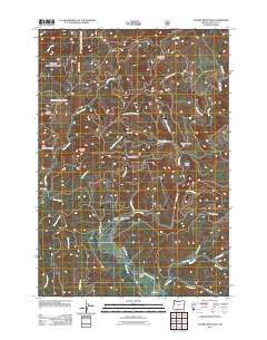
2011 Map of Euchre Mountain
USGS Topo · Published 2011About this map
Siletz River navigation and the timbered heights of the Oregon Coast Range dominate this 2011 survey of Lincoln County. The landscape is defined by its dramatic elevation changes, from the peak of Euchre Mountain to the confined depths of Lower Gorge. Remote outposts and landmarks like Peck Cabin and Upper Farm point to the area's history of isolated homesteading and forestry management. The river's winding course is marked by distinct locations such as Powderhouse Hole and the Euchre Falls on a namesake tributary. Along the southern reaches, a network of mountain roads including Mill Creek Rd and Moonshine Park Rd provides access to the drainage basins of Mill Creek and Cerine Creek. This map details a region where the geography of ridges, such as Wildcat Ridge, and creek systems like Coon Creek and Thompson Creek dictate the patterns of human presence and movement.
Find a feature on this map
39 named features on this map. Tap any name to fly to it.
Don’t see what you’re looking for? This feature index may not catch every label — zoom into the map to look around manually.
Map Details
Editions of this 2011 Euchre Mountain Map
This is the sole edition of this map. No revisions or reprints were ever made.
Other maps of this area

1939 · Marys Peak
USGS Topo · 1:62,500

1942 · Euchre Mtn
USGS Topo · 1:62,500

1942 · Marys Peak
USGS Topo · 1:62,500

1942 · Valsetz
USGS Topo · 1:62,500

1942 · Toledo
USGS Topo · 1:62,500

1943 · Euchre Mtn
USGS Topo · 1:62,500

1953 · Salem
USGS Topo · 1:250,000

1954 · Salem
USGS Topo · 1:250,000

1956 · Valsetz
USGS Topo · 1:62,500

1957 · Marys Peak
USGS Topo · 1:62,500