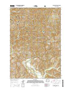
2014 Map of Euchre Mountain
USGS Topo · Published 2014About this map
Euchre Mountain and its smaller counterpart, Little Euchre Mtn, dominate this northern Oregon landscape within the Siuslaw National Forest. The southern portion of the map is defined by the winding course of the Siletz River, which flows past local landmarks like Powderhouse Hole and the Lower Gorge. This terrain is deeply etched by a complex drainage system, where Euchre Cr meets the celebrated Euchre Falls, while S Fork Buck Cr and Sunshine Cr feed into the larger river valley from the surrounding ridges. Access into this timbered backcountry is provided by several forest routes, including Werner Rd and Euchre Mountain Rd, which snake through high points such as Wildcat Ridge and Gobblers Knob. The area remains a notable example of the Pacific Northwest's interconnected river and ridge systems, showing the reach of the national forest boundaries across Lincoln County.
Find a feature on this map
41 named features on this map. Tap any name to fly to it.
Don’t see what you’re looking for? This feature index may not catch every label — zoom into the map to look around manually.
Map Details
Editions of this 2014 Euchre Mountain Map
This is the sole edition of this map. No revisions or reprints were ever made.
Other maps of this area

1939 · Marys Peak
USGS Topo · 1:62,500

1942 · Euchre Mtn
USGS Topo · 1:62,500

1942 · Marys Peak
USGS Topo · 1:62,500

1942 · Valsetz
USGS Topo · 1:62,500

1942 · Toledo
USGS Topo · 1:62,500

1943 · Euchre Mtn
USGS Topo · 1:62,500

1953 · Salem
USGS Topo · 1:250,000

1954 · Salem
USGS Topo · 1:250,000

1956 · Valsetz
USGS Topo · 1:62,500

1957 · Marys Peak
USGS Topo · 1:62,500