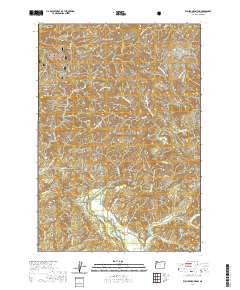
2020 Map of Euchre Mountain
USGS Topo · Published 2020About this map
The Siuslaw National Forest encompasses much of this coastal range landscape, dominated by the winding course of the Siletz River as it flows through the southern half of the quadrangle. The terrain is defined by prominent peaks and ridges, including Euchre Mtn, Little Euchre Mtn, and the high ground of Wildcat Ridge. Significant water features such as Euchre Falls and the Lower Gorge illustrate the dramatic elevation changes and drainage patterns of the area, while smaller tributaries like Mill Cr, Wolfer Cr, and Sunshine Cr branch through the timberlands. Named landmarks like Powderhouse Hole on the river and Black Tank Saddle provide specific points of interest for navigating this forest environment. Access into these uplands is primarily via forest and service roads like Moonshine Park Rd and Mill Creek Rd, which follow the natural valleys carved by the river and its creeks.
Find a feature on this map
43 named features on this map. Tap any name to fly to it.
Don’t see what you’re looking for? This feature index may not catch every label — zoom into the map to look around manually.
Map Details
Editions of this 2020 Euchre Mountain Map
This is the sole edition of this map. No revisions or reprints were ever made.
Other maps of this area

1939 · Marys Peak
USGS Topo · 1:62,500

1942 · Euchre Mtn
USGS Topo · 1:62,500

1942 · Marys Peak
USGS Topo · 1:62,500

1942 · Valsetz
USGS Topo · 1:62,500

1942 · Toledo
USGS Topo · 1:62,500

1943 · Euchre Mtn
USGS Topo · 1:62,500

1953 · Salem
USGS Topo · 1:250,000

1954 · Salem
USGS Topo · 1:250,000

1956 · Valsetz
USGS Topo · 1:62,500

1957 · Marys Peak
USGS Topo · 1:62,500