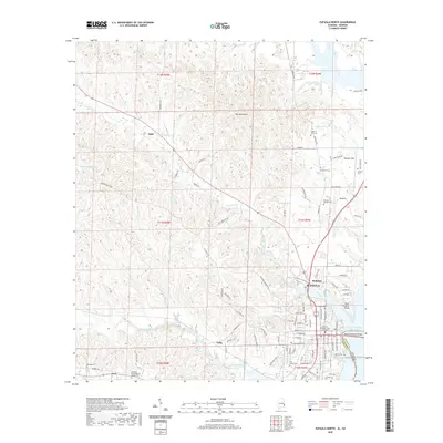
2020 Map of Eufaula North
USGS Topo · Published 2020About this map
The city of Eufaula sits on the high bluffs overlooking the Walter F George Reservoir, where the state line follows the water between Alabama and Georgia. This 2020 rendering shows a landscape defined by the deep ravines of the Barbour Creek and Chewalla Creek watersheds, which create the prominent ridges known locally as The Mountains. The civic heart of the area is anchored by the Barbour Eufaula County Courthouse, surrounded by several historic burial grounds including Fairview Cem and the Memory Garden Cem. Outside the main settlement, the map documents smaller communities and crossroads like Lugo, Tullis, and Hoboken. Genealogists will find value in the precise locations of outlying rural churches and family-named cemeteries such as Antioch Cem, McGee Cem, and the Pleasant Grove Baptist Church Cem near Osco.
Find a feature on this map
100 named features on this map. Tap any name to fly to it.
Don’t see what you’re looking for? This feature index may not catch every label — zoom into the map to look around manually.
Map Details
Editions of this 2020 Eufaula North Map
This is the sole edition of this map. No revisions or reprints were ever made.
Other maps of this area

1953 · Dothan
USGS Topo · 1:250,000

1954 · Dothan
USGS Topo · 1:250,000

1955 · Dothan
USGS Topo · 1:250,000

1955 · Phenix City
USGS Topo · 1:250,000

1957 · Phenix City
USGS Topo · 1:250,000

1958 · Phenix City
USGS Topo · 1:250,000

1967 · Hatcher
USGS Topo · 1:24,000

1967 · Georgetown
USGS Topo · 1:24,000

1968 · Eufaula North
USGS Topo · 1:24,000

1968 · Baker Hill
USGS Topo · 1:24,000