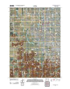
2011 Map of Eugene West
USGS Topo · Published 2011About this map
Amazon Creek and its managed waterways, including the Amazon Creek Diversion Channel, define the drainage and development patterns of the western outskirts of Eugene. This 2011 survey documents the expanding residential and industrial interface of neighborhoods like Santa Clara, Bethel, and Danebo. The map captures significant infrastructure, from the rail operations at Eugene Yard and the O E Ry Crossing to the sprawling grounds of Mahlon Sweet Field Airport in the north.
Find a feature on this map
89 named features on this map. Tap any name to fly to it.
Don’t see what you’re looking for? This feature index may not catch every label — zoom into the map to look around manually.
Map Details
Editions of this 2011 Eugene West Map
This is the sole edition of this map. No revisions or reprints were ever made.
Other maps of this area

1909 · Elmira
USGS Topo · 1:62,500

1910 · Eugene
USGS Topo · 1:62,500

1921 · Cottage Grove
USGS Topo · 1:62,500

1922 · Elmira
USGS Topo · 1:62,500

1940 · Eugene
USGS Topo · 1:62,500

1942 · Elmira
USGS Topo · 1:62,500

1942 · Crow
USGS Topo · 1:62,500

1945 · Crow
USGS Topo · 1:62,500

1946 · Eugene
USGS Topo · 1:62,500

1949 · Eugene
USGS Topo · 1:62,500