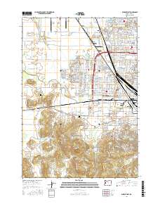
2017 Map of Eugene West
USGS Topo · Published 2017About this map
Mahlon Sweet Field dominates the northwestern corner of this landscape, marking the infrastructure of West Eugene as it appeared in the late 2010s. The transition from the urban density of Bethel and Danebo to the western hills and wetlands is clearly defined by the Southern Pacific rail line and the complex drainage of the Amazon Creek Diversion Channel. Genealogists will find a cluster of significant burial sites along the western edge of the city, including Oak Hill Cem, West Lawn Memorial Park, and Lane Memorial Gardens. The terrain rises sharply to the south into the Wild Iris Ridge and Bailey Hill, overlooking the city's growth toward Santa Clara and Fir Grove. This survey captures the essential hydrologic network of Amazon Cr and Willow Cr alongside industrial corridors and established residential neighborhoods.
Find a feature on this map
300 named features on this map. Tap any name to fly to it.
Don’t see what you’re looking for? This feature index may not catch every label — zoom into the map to look around manually.
Map Details
Editions of this 2017 Eugene West Map
This is the sole edition of this map. No revisions or reprints were ever made.
Other maps of this area

1909 · Elmira
USGS Topo · 1:62,500

1910 · Eugene
USGS Topo · 1:62,500

1921 · Cottage Grove
USGS Topo · 1:62,500

1922 · Elmira
USGS Topo · 1:62,500

1940 · Eugene
USGS Topo · 1:62,500

1942 · Elmira
USGS Topo · 1:62,500

1942 · Crow
USGS Topo · 1:62,500

1945 · Crow
USGS Topo · 1:62,500

1946 · Eugene
USGS Topo · 1:62,500

1949 · Eugene
USGS Topo · 1:62,500