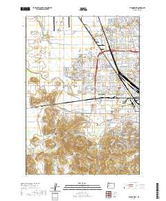
2020 Map of Eugene West
USGS Topo · Published 2020About this map
Eugene expands westward across the Willamette Valley floor in this recent survey, showing the intricate balance between suburban development and the natural drainage of the Amazon Cr basin. The landscape is defined by its transition from the urban density of Bethel and River Road to the agricultural and industrial fringes near Danebo. Notable topographical anchors like Fir Butte, Crabtree Hill, and Cantrell Hill rise above the flatlands, providing contrast to the engineered water management of the Amazon Creek Diversion Channel.
Find a feature on this map
268 named features on this map. Tap any name to fly to it.
Don’t see what you’re looking for? This feature index may not catch every label — zoom into the map to look around manually.
Map Details
Editions of this 2020 Eugene West Map
This is the sole edition of this map. No revisions or reprints were ever made.
Other maps of this area

1909 · Elmira
USGS Topo · 1:62,500

1910 · Eugene
USGS Topo · 1:62,500

1921 · Cottage Grove
USGS Topo · 1:62,500

1922 · Elmira
USGS Topo · 1:62,500

1940 · Eugene
USGS Topo · 1:62,500

1942 · Elmira
USGS Topo · 1:62,500

1942 · Crow
USGS Topo · 1:62,500

1945 · Crow
USGS Topo · 1:62,500

1946 · Eugene
USGS Topo · 1:62,500

1949 · Eugene
USGS Topo · 1:62,500