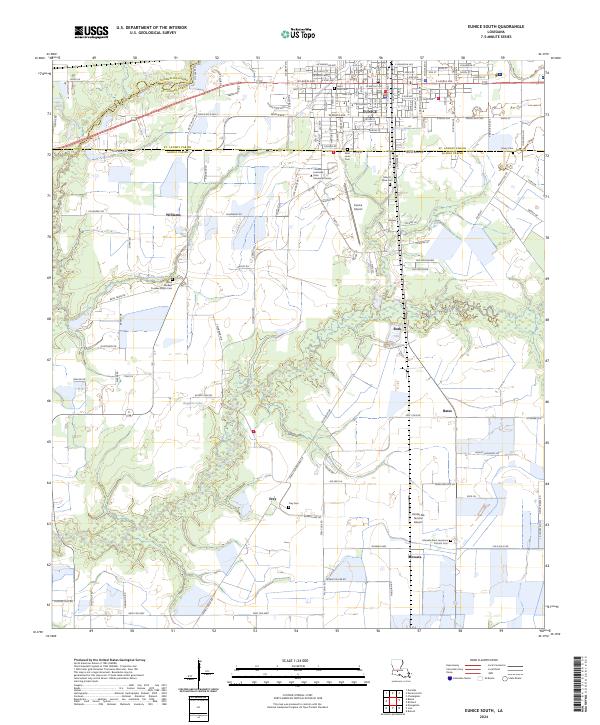
2024 Map of Eunice South
USGS Topo · Published 2024About this map
Eunice serves as the focal point for this survey of south-central Louisiana, marking the intersection of the Evangeline and St. Landry Parish lines. The landscape south of the city is defined by expansive agricultural fields and specialized rural facilities like the Kinder Ag Service Airport and the campus of Louisiana State University Eunice. Small settlements and family enclaves such as Mowata, Frey, Rork, and Williams dot the prairie, often centered around long-standing community landmarks. Genealogists will find a dense concentration of burial sites including the Mowata Saint Lawrence Catholic Cem, Saint Paul Cem, and the uniquely named Riche Herbert Fuselier Dupre Cem. Water features like Richards Gully and Ruppert Lake break the grid-like pattern of rural roads, illustrating the drainage patterns essential to the local farming economy.
Find a feature on this map
60 named features on this map. Tap any name to fly to it.
Don’t see what you’re looking for? This feature index may not catch every label — zoom into the map to look around manually.
Map Details
Editions of this 2024 Eunice South Map
This is the sole edition of this map. No revisions or reprints were ever made.
Other maps of this area

1935 · Branch
USGS Topo · 1:31,680

1947 · Evangeline
USGS Topo · 1:31,680

1947 · Fruge Lake
USGS Topo · 1:31,680

1947 · Branch
USGS Topo · 1:31,680

1947 · Redland
USGS Topo · 1:31,680

1947 · Chataignier
USGS Topo · 1:31,680

1947 · Eunice
USGS Topo · 1:31,680

1947 · Iota
USGS Topo · 1:31,680

1947 · Pitreville
USGS Topo · 1:31,680

1947 · Basile
USGS Topo · 1:31,680