
Loading...
Loading map...1947 Map of Eunice
USGS Topo · Published 1947About this map
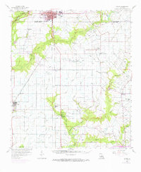
Eunice serves as the primary municipal hub in this region of south Louisiana, where the intersections of the Missouri Pacific and Louisiana Southern railroads define the local economy. The landscape is characterized by a transition from the structured grid of the city to the winding watercourses of Bayou des Cannes and Bayou Mallet. Numerous small prairie settlements and family-named landmarks are scattered across the parishes, including Mowata, Frey, and Amy.
Find a feature on this map
29 named features on this map. Tap any name to fly to it.
Don’t see what you’re looking for? This feature index may not catch every label — zoom into the map to look around manually.
Map Details
Date Portrayed1947
Date Published1947
PublisherU.S. Geological Survey
Map TypeTopographic
Scale1:31,680
Physical Dimensions16.9 x 20.9 inches
Editions of this 1947 Eunice Map
This is the sole edition of this map. No revisions or reprints were ever made.
Historical Maps of Eunice Through Time
Featured Locations
Source Details
SourceU.S. Geological Survey
CopyrightPublic Domain