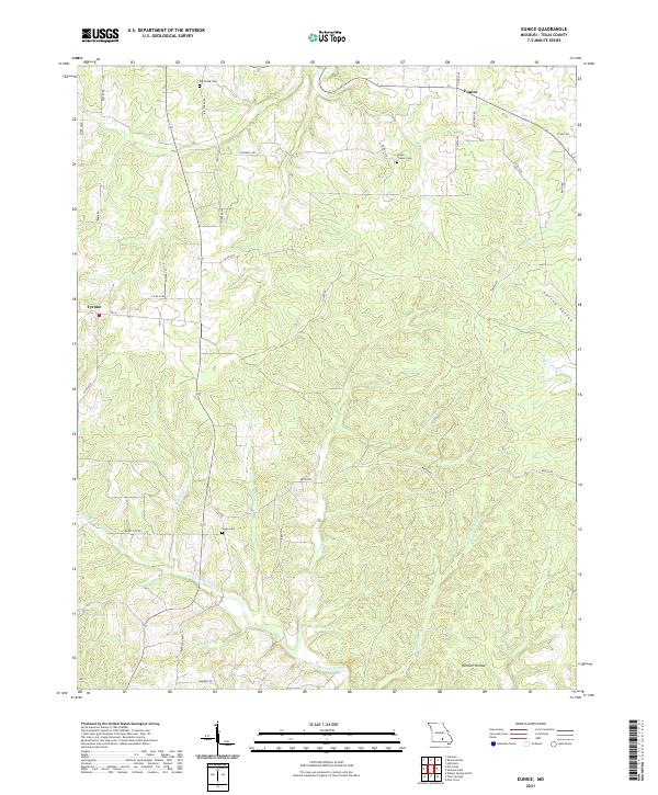
2021 Map of Eunice
USGS Topo · Published 2021About this map
Eunice and Tyrone anchor this section of Texas County, Missouri, where the Ozark landscape is defined by the headwaters of the N Prong Jacks Fork. The topography is a complex network of ridges and hollows, such as Harmon Hollow and the notable Spring Valley, which guide a multitude of local waterways. These include Big Cr in the north and several branches like Saddle Br and Sanders Br that feed into the larger river systems.
Find a feature on this map
41 named features on this map. Tap any name to fly to it.
Don’t see what you’re looking for? This feature index may not catch every label — zoom into the map to look around manually.
Map Details
Editions of this 2021 Eunice Map
This is the sole edition of this map. No revisions or reprints were ever made.
Other maps of this area

1932 · Cedar Grove
USGS Topo · 1:48,000

1945 · Clear Springs
USGS Topo · 1:62,500

1946 · Summersville
USGS Topo · 1:62,500

1948 · Clear Springs
USGS Topo · 1:62,500

1948 · Summersville
USGS Topo · 1:62,500

1949 · Rolla
USGS Topo · 1:250,000

1951 · Raymondville
USGS Topo · 1:24,000

1951 · Houston
USGS Topo · 1:24,000
1951 · Hartshorn
USGS Topo · 1:24,000

1951 · Raymondville
USGS Topo · 1:62,500