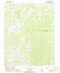
1987 Map of Eunice
USGS Topo · Published 1987About this map
Eunice and Tyrone anchor this section of the Ozark plateau in eastern Texas County, documented during a 1980s USGS provisional survey. The landscape is defined by the deep dissection of the North Prong Jacks Fork, where several named watercourses including Peters Creek, Saddle Branch, and Sanders Branch feed into the river system. This drainage pattern reveals the characteristic topography of the region, where narrow ridges separate winding hollows.
Find a feature on this map
17 named features on this map. Tap any name to fly to it.
Don’t see what you’re looking for? This feature index may not catch every label — zoom into the map to look around manually.
Map Details
Editions of this 1987 Eunice Map
This is the sole edition of this map. No revisions or reprints were ever made.
Other maps of this area

1932 · Cedar Grove
USGS Topo · 1:48,000

1945 · Clear Springs
USGS Topo · 1:62,500

1946 · Summersville
USGS Topo · 1:62,500

1948 · Clear Springs
USGS Topo · 1:62,500

1948 · Summersville
USGS Topo · 1:62,500

1949 · Rolla
USGS Topo · 1:250,000

1951 · Raymondville
USGS Topo · 1:24,000

1951 · Houston
USGS Topo · 1:24,000
1951 · Hartshorn
USGS Topo · 1:24,000

1951 · Raymondville
USGS Topo · 1:62,500