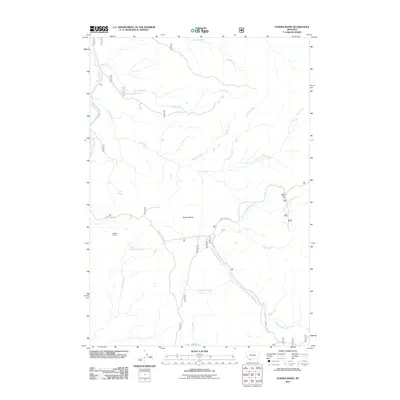
2011 Map of Eureka Basin
USGS Topo · Published 2011About this map
Eureka Basin anchors this high-country landscape in Beaverhead County, where the Continental Divide's hydrology begins to take shape. The terrain is defined by the headwaters of major drainages, most notably the Ruby River flowing to the west and the West Fork Madison River descending to the east. This 2011 survey records a network of mountain roads and remote outposts, including Williams Camp and the West Fork Rest Area, which serve as landmarks in an area dominated by seasonal access and public land management.
Find a feature on this map
20 named features on this map. Tap any name to fly to it.
Don’t see what you’re looking for? This feature index may not catch every label — zoom into the map to look around manually.
Map Details
Editions of this 2011 Eureka Basin Map
This is the sole edition of this map. No revisions or reprints were ever made.
Other maps of this area

1950 · Lower Red Rock Lake
USGS Topo · 1:62,500

1950 · Monument Ridge
USGS Topo · 1:62,500

1955 · Dubois
USGS Topo · 1:250,000

1955 · Ashton
USGS Topo · 1:250,000

1958 · Dubois
USGS Topo · 1:250,000

1958 · Ashton
USGS Topo · 1:250,000

1960 · Ashton
USGS Topo · 1:250,000

1968 · Stonehouse Mountain
USGS Topo · 1:24,000

1968 · Antelope Peak
USGS Topo · 1:24,000
1968 · Spur Mountain
USGS Topo · 1:24,000