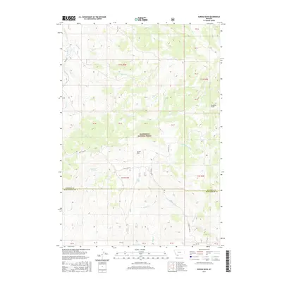
2017 Map of Eureka Basin
USGS Topo · Published 2017About this map
Beaverhead National Forest defines the topography of this high-elevation landscape along the boundary of Madison and Beaverhead counties. The drainage divide is marked by the Gravelly Range, which separates the headwaters of the Ruby River to the west from the W Fork Madison River to the east. This 2017 survey illustrates a complex hydrological network where several named springs, including Twin Springs, Long Creek Spring Number One, and Lone Willow Spring, feed into vital watercourses like Long Cr and Anderson Cr. The vastness of Eureka Basin is navigated primarily via the rugged Eureka Basin Rd and Gravelly Range Rd, providing a detailed look at the management boundaries and natural features of this southwestern Montana wilderness.
Find a feature on this map
41 named features on this map. Tap any name to fly to it.
Don’t see what you’re looking for? This feature index may not catch every label — zoom into the map to look around manually.
Map Details
Editions of this 2017 Eureka Basin Map
This is the sole edition of this map. No revisions or reprints were ever made.
Other maps of this area

1950 · Lower Red Rock Lake
USGS Topo · 1:62,500

1950 · Monument Ridge
USGS Topo · 1:62,500

1955 · Dubois
USGS Topo · 1:250,000

1955 · Ashton
USGS Topo · 1:250,000

1958 · Dubois
USGS Topo · 1:250,000

1958 · Ashton
USGS Topo · 1:250,000

1960 · Ashton
USGS Topo · 1:250,000

1968 · Stonehouse Mountain
USGS Topo · 1:24,000

1968 · Antelope Peak
USGS Topo · 1:24,000
1968 · Spur Mountain
USGS Topo · 1:24,000