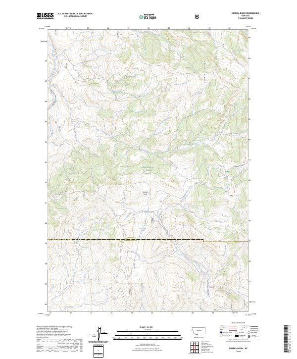
2024 Map of Eureka Basin
USGS Topo · Published 2024About this map
The high-elevation meadows and peaks of the Gravelly Range dominate this modern survey, which captures the complex hydrography of the Continental Divide's eastern slope. Located within the Beaverhead National Forest, the terrain is defined by the Eureka Basin and a network of critical headwaters. The map illustrates the divergence of flow between the Ruby River and the West Fork Madison River, documenting the vital water sources that sustain this landscape, including Lone Willow Spring and Twin Springs.
Find a feature on this map
26 named features on this map. Tap any name to fly to it.
Don’t see what you’re looking for? This feature index may not catch every label — zoom into the map to look around manually.
Map Details
Editions of this 2024 Eureka Basin Map
This is the sole edition of this map. No revisions or reprints were ever made.
Other maps of this area

1950 · Lower Red Rock Lake
USGS Topo · 1:62,500

1950 · Monument Ridge
USGS Topo · 1:62,500

1955 · Dubois
USGS Topo · 1:250,000

1955 · Ashton
USGS Topo · 1:250,000

1958 · Dubois
USGS Topo · 1:250,000

1958 · Ashton
USGS Topo · 1:250,000

1960 · Ashton
USGS Topo · 1:250,000

1968 · Stonehouse Mountain
USGS Topo · 1:24,000

1968 · Antelope Peak
USGS Topo · 1:24,000
1968 · Spur Mountain
USGS Topo · 1:24,000