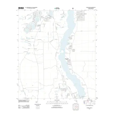
2012 Map of Eureka Dam
USGS Topo · Published 2012About this map
Lake Ocklawaha dominates this Central Florida landscape, with the Eureka Dam situated at the southern end of the water body. The area is characterized by a high density of small lakes and landings along the river's edge, illustrating a local geography defined by its hydrology. Settlements such as Hog Valley and various riverside landings including Cracker Landing, Tobacco Patch Landing, and Wells Landing indicate a history of river-access development. Inland, a complex of named water bodies like Island Lake, Deer Back Lake, and Bay Lake provides a clear view of the region's diverse karst topography. Genealogists may find interest in the location of Cornelius Cem, positioned north of Island Lake and west of the primary waterway.
Find a feature on this map
117 named features on this map. Tap any name to fly to it.
Don’t see what you’re looking for? This feature index may not catch every label — zoom into the map to look around manually.
Map Details
Editions of this 2012 Eureka Dam Map
This is the sole edition of this map. No revisions or reprints were ever made.
Other maps of this area

1893 · Citra
USGS Topo · 1:62,500

1895 · Citra
USGS Topo · 1:62,500

1915 · Interlachen
USGS Topo · 1:48,000

1916 · Interlachen
USGS Topo · 1:62,500

1938 · Hawthorn
USGS Topo · 1:48,000

1943 · Hawthorn
USGS Topo · 1:62,500

1944 · Interlachen
USGS Topo · 1:62,500

1949 · Keuka
USGS Topo · 1:24,000

1949 · Rodman
USGS Topo · 1:24,000

1949 · Interlachen
USGS Topo · 1:62,500